Discover issues before they can impact your yield this season

Discover crop variability due to weather
Get maps that clearly show the changes in biomass development due to weather conditions like drought or flooding.

Monitor field trial performance
Satellite imagery powered biomass maps can easily analyse progress and evaluate any new practices or products you’re testing.

Detect problems early
With the satellite imagery updated every 3 to 5 days, you can identify potential problem areas after seeding and improve crop performance.

Monitor N-applications
Atfarm’s biomass maps help you monitor the effectiveness of N-applications and variable fertilisation in any field.
Track progress and problems
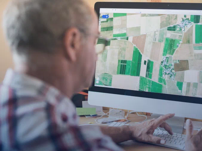
Powerful biomass maps that help you monitor crop health, field variability, and detect problem areas on your fields from anywhere, anytime.
Advanced technology
Atfarm uses Yara’s N-Sensor vegetation index to generate biomass maps to help you understand your fields better.
Advanced technology gives you insights beyond traditional crop monitoring

Sentinel-2 Satellites from the European Space Agency
Sentinel-2 images capture the red edge of light which gives you insights into the health of your crops and field far before your eyes could notice any anomalies.
New high-resolution images are added to Atfarm every 3 to 5 days. You can also access 2 years of historical field images and biomass maps to track trends.

Crop health insights beyond what the human eye can see
The N-Sensor vegetation index was developed by Yara agronomists. It is based on more than 25 years of field trials and crop modelling.
Biomass maps created with the N-Sensor index and Sentinel-2 images help you monitor your crop development with more precision than ever before.

Know what is happening on your fields no matter where you are
Easily track and monitor crop development throughout the season from almost any device with an internet connection.
Stay connected to your fields throughout the season with Atfarm.
Like a security system for your fields throughout the season
How to use Satellite Monitoring on your computer or smartphone:
- Log in to Atfarm
- Add your field
- Select a cloud-free image
- See the biomass of your fields
Satellite Monitoring is calibrated to accurately measure the biomass of most crops